G&G and Geo-modeling Software |
Innovated by Aroundwave. A complete new software including seismic interpretation, mapping tools, velocity modeling, 3D geo-modeling and data integration and data management.
Features and Functions for Seismic Interpretation:
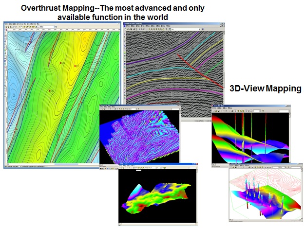
- Overthrust interpretation and mapping in one step
- Time-Depth conversion on section by using the velocity Field and do interpretation in time and depth domain interactively
- Reservoir description and structural interpretation and evolution can be done on depth section directly
- Well and seismic data integrated analysis
- Directional well design on seismic or attribute section with more accuracy
- Advanced 3D visualization in the industry
Features and Functions for Mapping Tool:
- Focus on application and intehration of map and data.
- Open all data format and "Green Data" concept.
- Mapping type include flat surface map, section map, 3D map and cross well map.
- Overthrust mapping
- Nature coloring of sudden change or gradual change
- Layered map management for big amount of map process
- Easy editing function
- Assist calculation on the map
Features and Functions for Velocity Model:
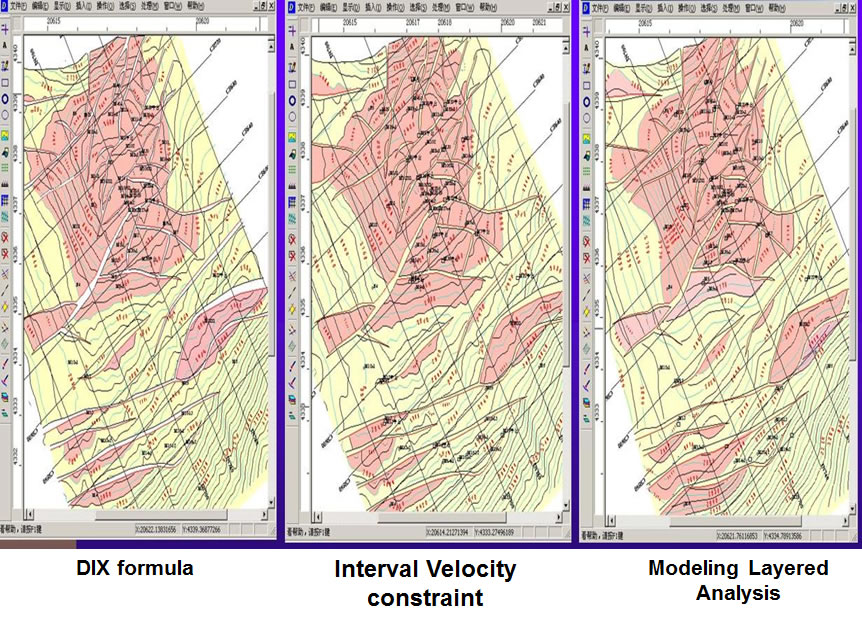
Awave uses the velocity spectrum to set up the velocity field, then generate the real-time T-D conversion, which further integrate the well data into seismic data. This can have the similar result of PSDM, and the following advantages:
- It is easier and quicker to set up the velocity field through velocity spectrum. This meets the velocity accuracy required by oil and gas exploration
- Spacial variable velocity field enables us to do the Time and depth domain conversion in real-time, and keeps the time domain features of the raw seismic data. This will make it easier for us to re-process the post stack data
- Use the variable velocity field to convert the interpreted seismic data result into high accurate geological results and maps.
 Facebook
 Twitter
 LinkedIn
 Delicious